Twitter: @DrNeilHumpage
By Dr Neil Humpage, University of Leicester, UK; email: nh58@le.ac.uk
From the 16th to 22nd of January 2020, Dr Neil Humpage (University of Leicester) visited Jinja, Uganda, to set up a Bruker EM27/SUN spectrometer which will make measurements of greenhouse gases in the atmosphere overhead during the coming months.
The partnership
The spectrometer deployment is the result of a partnership between the University of Leicester and the National Fisheries Resources Research Institute (NaFIRRI), who are hosting the spectrometer at their headquarters in Jinja. This partnership came about by way of contacts made in the Ugandan environmental science community by Dr Jenny Farmer, who was living near Jinja (as well as making in-situ measurements for the MOYA project) back when we were considering where we could locate our spectrometer for MOYA. She put me in touch with Dr William Okello, who turned out to be very keen on the idea of hosting our greenhouse gas monitoring equipment at NaFIRRI, and has been very supportive throughout the organisation and execution of this deployment.

A look inside the spectrometer enclosure (photo by Neil Humpage)

Figure 2: The NaFIRRI building upon whose roof we will monitor the composition of the air over Jinja (photo by Neil Humpage)
How does it work?
The spectrometer (Figure 1) works by observing light from the Sun, which it splits onto a fine wavelength grid to produce absorption spectra of the atmosphere at a rate of one every 75 seconds (whenever there are cloud-free conditions). By looking at the specific wavelengths where light is absorbed by the gases we are interested in (methane, carbon dioxide and carbon monoxide) and measuring how much light is absorbed at those wavelengths, we can estimate with a very good degree of accuracy the total column concentration of these gases in the air overhead. The instrument requires a flat surface with clear sightlines to the Sun throughout the day, along with access to a power supply: hence the need to lift everything onto the roof at NaFIRRI (Figure 2 to 6), using the crane on the back of a truck normally used for breakdown recovery!

Figure 3: Lifting the spectrometer and its enclosure on the roof at NaFIRRI (Photo by Neil Humpage)
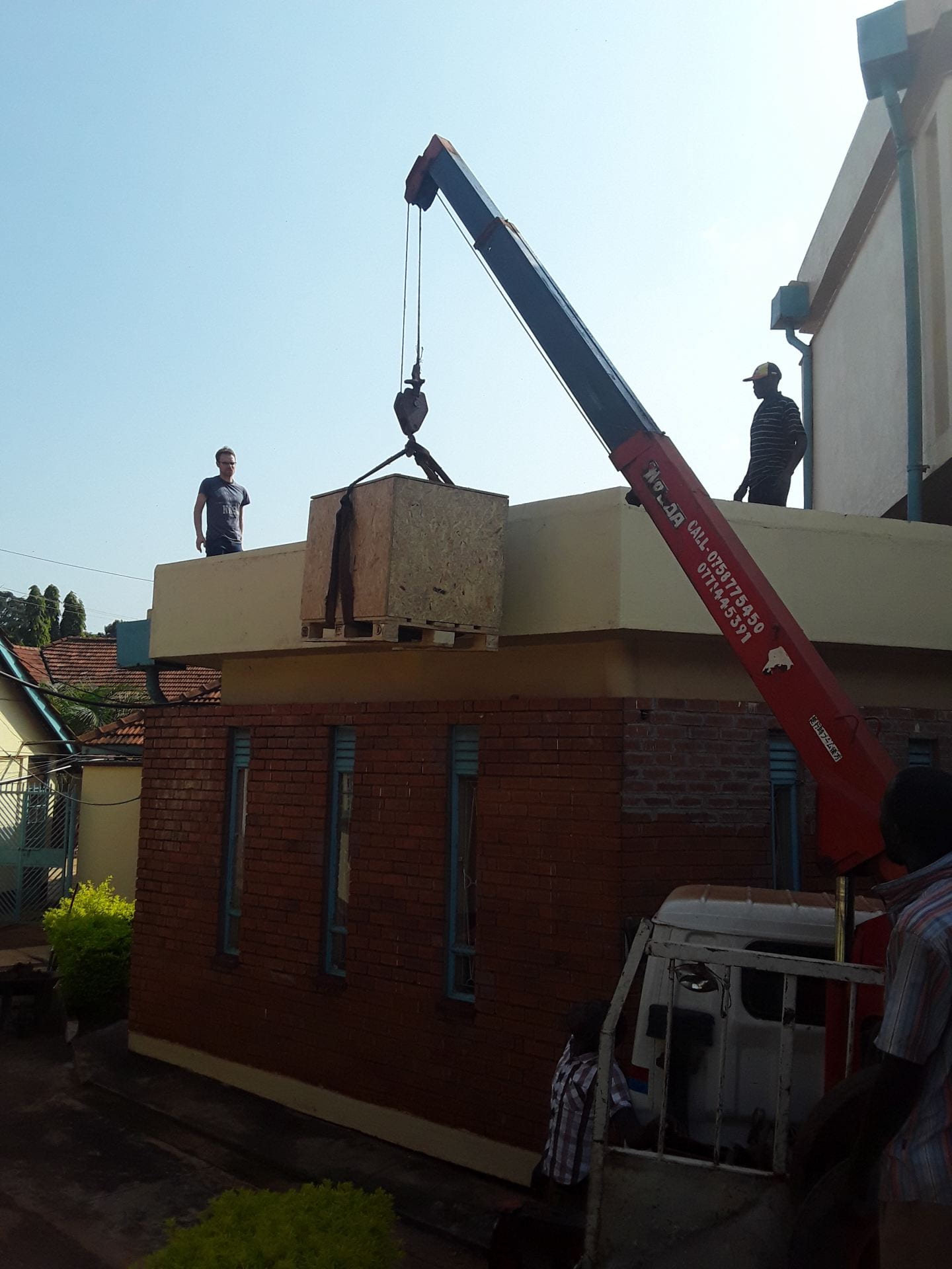
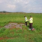
Figure 4: Neil Humpage watches on as the enclosure and spectrometer are hoisted onto the roof (photo by William Okello)
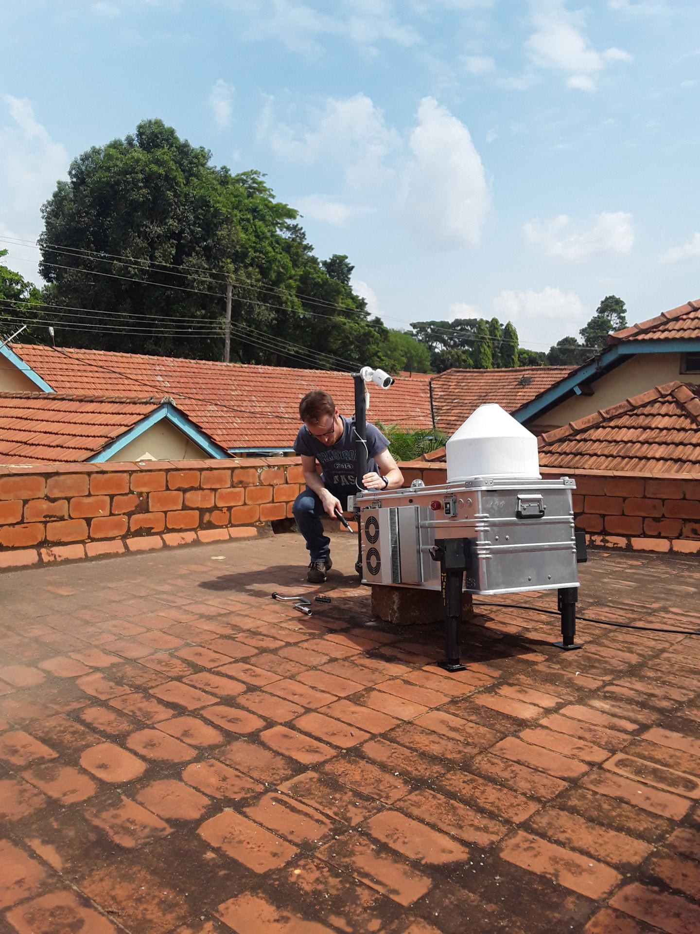
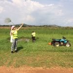
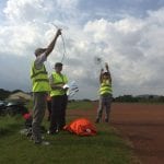
Figure 5: Neil Humpage setting up the enclosure (photo by William Okello)
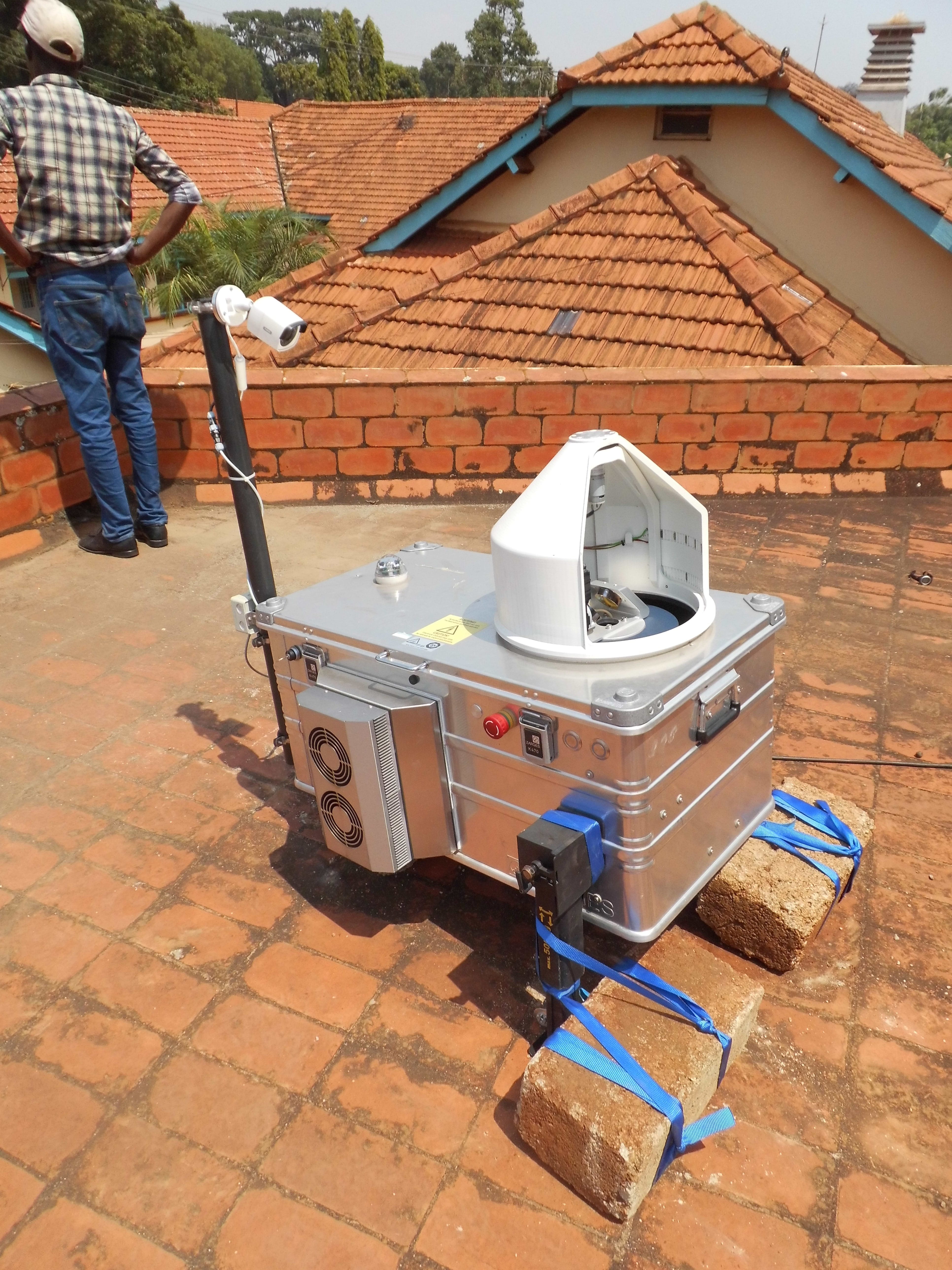
Figure 6: The spectrometer with its rain cover open, allowing observations of the Sun (photo by Neil Humpage)
Why use remote sensing?
There are several reasons why it is useful to remotely measure gaseous composition of the atmosphere in this way. Compared with directly taking air samples and analysing them to find out the mixture of gases present, this ground based remote sensing technique is sensitive to air originating from a wider range of sources than that of a single in-situ air sample. Whilst this throws up certain challenges when it comes to interpreting the data (understanding where the air you’re measuring has come from, and what sources of different gases it has passed over along the way), it does mean that the results are less susceptible to bias as a result of location – the air being measured is representative of the surrounding region (with the exact footprint we’re sensitive to being dependent on meteorology). This also means that the ground based, remotely sensed column concentrations we will measure particularly useful for studying regional sources and sinks, since the retrieved column data shows less sensitivity to local sources than that obtained from in-situ measurements.
Methane and Uganda
Of most relevance to the MOYA project are the measurements of methane, which we think will prove to be very interesting. One of the primary goals of MOYA is to understand the relative importance of the many different processes – both natural and anthropogenic – which are affecting the recent trends in global concentrations of atmospheric methane. Tropical wetlands are one of the most important natural sources of methane, which makes Uganda – where over 10% of its land surface is covered by wetlands – an excellent location for these measurements. In addition to our specific interest in methane, our capability to simultaneously measure carbon dioxide and carbon monoxide can give us a more general impression of Uganda’s greenhouse gas emissions from fossil fuel consumption, transport, and fires (see Figure 7 for an overview of what we hope to achieve in Uganda).
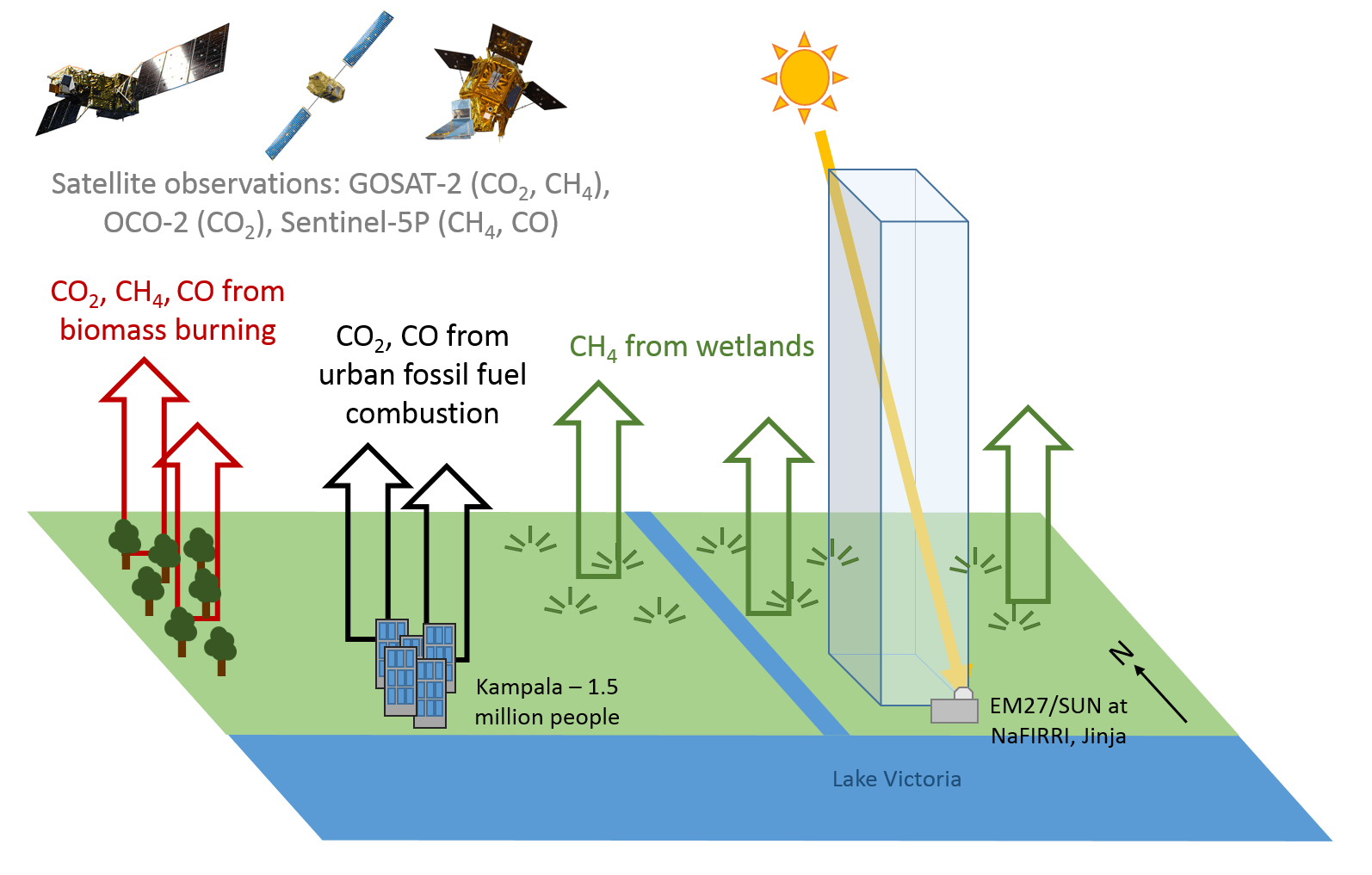
Figure 7: A schematic diagram showing some of the different greenhouse gas sources we expect to observe and investigate
A further motivation for making these measurements in Uganda is to provide a validation dataset for our colleagues working on global satellite observations of these gases. We rely on ground-based validation measurements to provide confidence in the quality of these global greenhouse gas datasets derived from satellites. The established ground-based spectrometer networks (e.g. the Total Column Carbon Observing Network, or TCCON) unfortunately do not include any locations on the continent of Africa (Figure 8). By temporarily filling this gap, the dataset we produce from our spectrometer measurements here in Jinja should prove to be of great value to the global greenhouse gas remote sensing community.
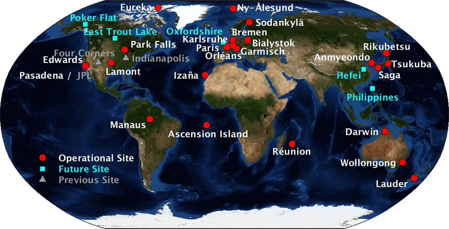
Figure 8: Locations of the TCCON ground-based measurements used to validate satellite data (see www.tccon.caltech.edu)
Whilst my visit to Jinja on this occasion was relatively brief (and unfortunately a bit too busy for much in the way of sightseeing!), I was made to feel very welcome by Dr Okello and his colleagues at NaFIRRI (Figures 9 to 10), whose efforts were instrumental in getting the spectrometer and its enclosure up on the roof and running successfully. I’m very much looking forward to visiting Jinja again soon, with plans in the pipeline for a seminar and further engagement with the scientists at NaFIRRI on where our respective interests – satellite and ground-based remote sensing, and biological processes in rivers and lakes – might overlap and generate ideas for further collaboration.
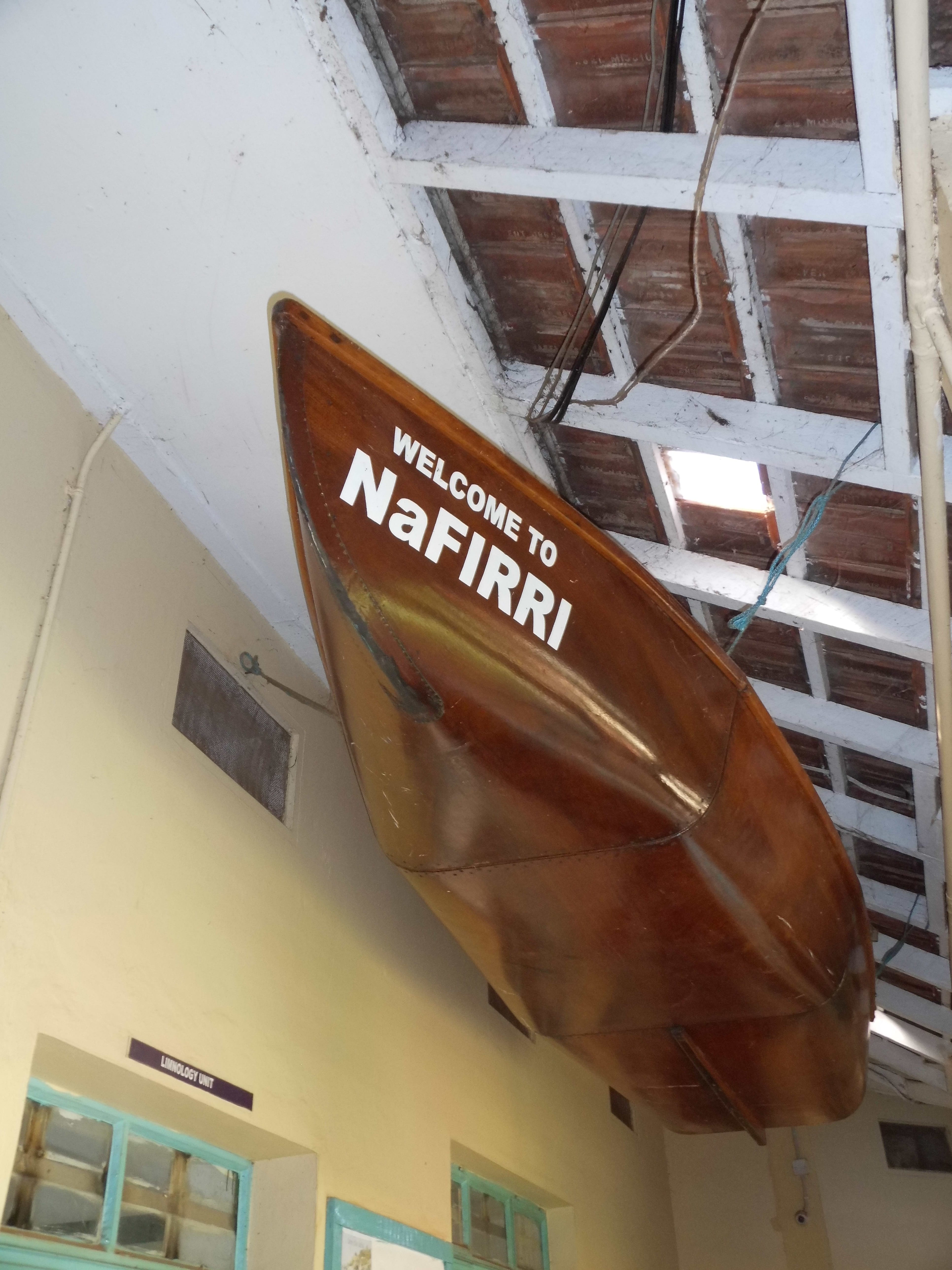
Figure 9: ‘Welcome to NaFIRRI’ – rowing boat on display at the NaFIRRI headquarters in Jinja (photo by Neil Humpage)
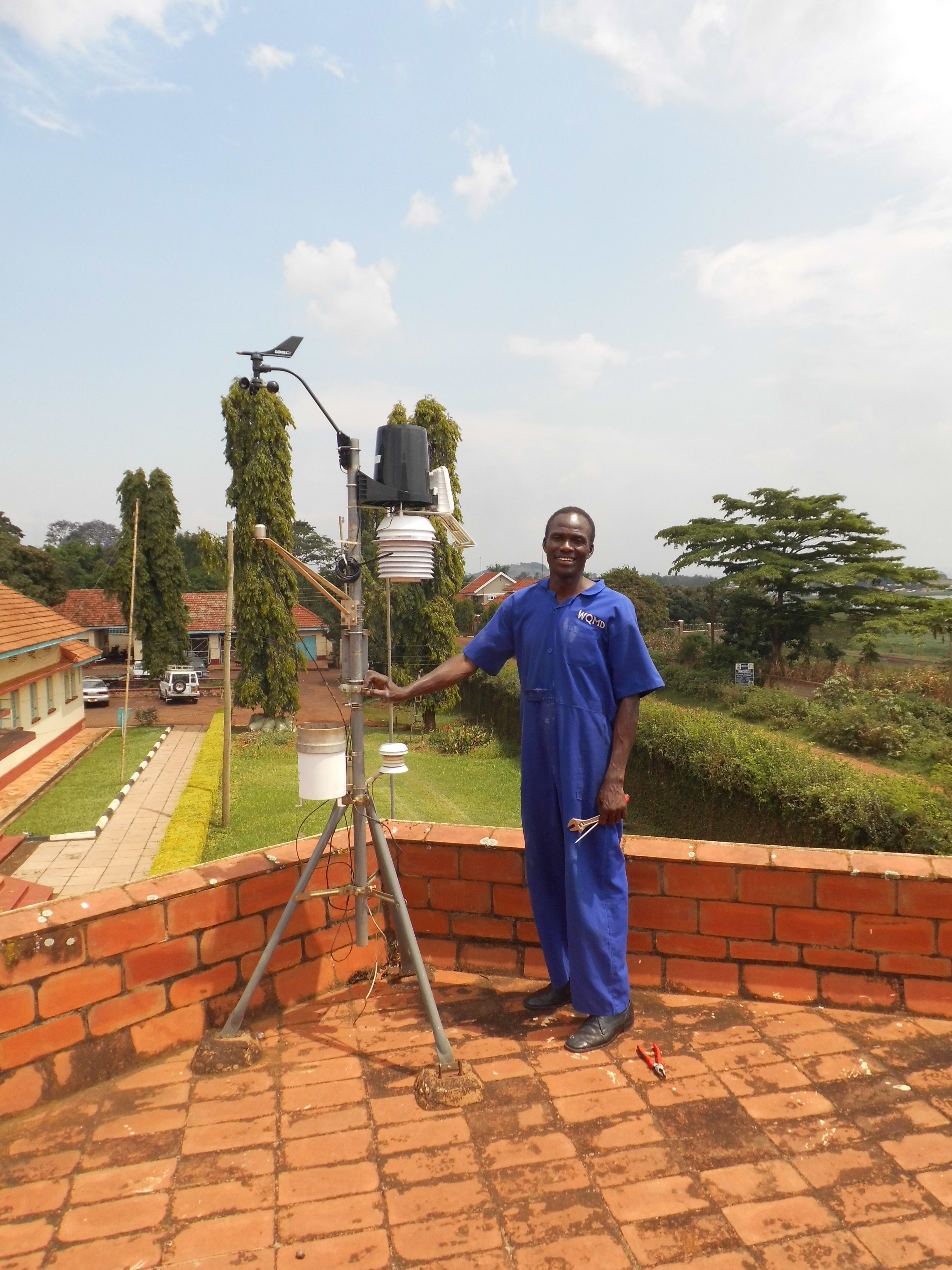
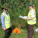
Figure 10: William Okello of NaFIRRI, helping to set up our weather station (photo by Neil Humpage)